Interior of the Earth – Complete Guide For Class 11 Geography Chapter 3

Welcome to iPrep, your Learning Super App. Our learning resources for the chapter, Interior of the Earth in Geography for Class 11th are designed to ensure that you grasp this concept with clarity and perfection. Whether you’re studying for an upcoming exam or strengthening your concepts, our engaging animated videos, practice questions and notes offer you the best of integrated learning with interesting explanations and examples. 

This chapter explores the structure and composition of the Earth’s interior, drawing on various sources of information to understand the layers beneath the surface. It examines the characteristics of the crust, mantle, and core, as well as the phenomena of earthquakes and volcanoes.

The Earth’s interior is a vast and mysterious realm, hidden beneath the surface. This chapter delves into the methods used to study the Earth’s interior and the knowledge we have gained about its structure and composition.

Objectives of Learning The Chapter – Interior Of The Earth

Now that we have explored the importance of the chapter, let’s outline the objectives of studying it.

  • To understand the different sources of information about the Earth’s interior.
  • To explore the structure and composition of the Earth’s crust, mantle, and core.
  • To analyze the phenomena of earthquakes and volcanoes.
  • To examine the effects of earthquakes and volcanic activity.

Now let’s explore the various sections of the chapter.

Firstly, to understand how we gather knowledge about the Earth’s interior, let’s delve into the section on Sources of Information About the Interior of the chapter Interior of the Earth.

Sources of Information About the Interior

Scientists use a variety of methods to study the Earth’s interior, including direct and indirect sources.

  • Direct Sources
    • Direct sources of information include samples of rocks and minerals from the Earth’s crust.
  • Indirect Sources
    • Indirect sources include seismic waves, magnetic field measurements, and gravitational anomalies.

Now, to understand the phenomenon of earthquakes, let’s delve into the section on Earthquakes in the chapter Interior of the Earth.

Earthquake

Earthquakes are caused by the sudden release of energy stored in the Earth’s crust.

Earthquake Waves

  • Primary Waves (P-Waves): These are the fastest seismic waves and can travel through both solid and liquid layers of the Earth.
  • Secondary Waves (S-Waves): These waves are slower than P-waves and can only move through solid materials.
  • Surface Waves: These are the slowest but most destructive waves, traveling along the Earth’s surface.
a visual of earthquake waves from class 11 geography chapter 3 - Interior of the earth

Propagation of Earthquake Waves

  • Refraction and Reflection: Seismic waves change direction when they pass through different layers, providing information about the Earth’s interior.
  • Velocity Changes: Variations in wave velocity help determine the properties of different layers.

Emergence of Shadow Zone

  • Shadow Zone: A region on the Earth’s surface where seismic waves are not detected, indicating the presence of different materials in the Earth’s interior.
image 5

Types of Earthquakes

  • Tectonic Earthquakes: Caused by the movement of tectonic plates.
  • Volcanic Earthquakes: Associated with volcanic activity.
  • Collapse Earthquakes: Result from the collapse of underground caverns or mines.
  • Explosion Earthquakes: Caused by man-made explosions.

Measuring Earthquakes

  • Richter Scale: Measures the magnitude of an earthquake.
  • Mercalli Intensity Scale: Assesses the intensity based on observed effects.

Now, to understand the impact of earthquakes, let’s explore the section on the Effects of Earthquake in the chapter Interior of the Earth.

Effects of Earthquake

Earthquakes can have devastating consequences, including loss of life, property damage, and infrastructure disruption. Some of the effects include:

Surface Rupture: The breaking of the Earth’s surface along a fault line.

Ground Shaking: The most common effect, causing structural damage.

Tsunamis: Large sea waves generated by underwater earthquakes.

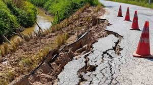
Landslides: Earthquakes can trigger landslides, especially in hilly regions.

image 8

Frequency of Earthquake Occurrences

  • Global Distribution: Earthquakes are more frequent along tectonic plate boundaries.
  • Seismic Zones in India: The chapter also highlights regions in India prone to earthquakes.

Now, in order to understand the layers of the Earth, let’s delve into the section on the Structure of the Earth in the chapter Interior of the Earth.

Structure of the Earth

The Earth is composed of three main layers: the crust, the mantle, and the core.

The Crust

  • Oceanic Crust: Thinner and denser, primarily composed of basalt.
  • Continental Crust: Thicker and less dense, composed mainly of granite.

The Mantle

  • Upper Mantle: Extends below the crust and is composed of silicate minerals.
  • Lower Mantle: More rigid due to high pressure, composed of magnesium and iron silicates.

The Core

  • Outer Core: Liquid, composed mainly of iron and nickel.
  • Inner Core: Solid, with a similar composition to the outer core.
image 4

Now, to delve deeper into volcanic activity, let’s explore the section on Volcanoes and Volcanic Landforms in the chapter Interior of the Earth.

Volcanoes and Volcanic Landforms

Volcanoes are openings in the Earth’s crust through which magma erupts.

Volcanoes

  • Shield Volcanoes: Large, broad volcanoes with gentle slopes, formed by the eruption of low-viscosity lava.
  • Composite Volcanoes: Also known as stratovolcanoes, they have steep slopes and are formed by alternating layers of lava and ash.
  • Caldera: A large volcanic crater formed by the collapse of a volcano after an eruption.
  • Flood Basalt Provinces: Large areas covered by basaltic lava flows.
  • Mid-Ocean Ridge Volcanoes: Volcanoes that form along mid-ocean ridges where tectonic plates are diverging.
image 6

Shield Volcano   

image 10
image 9

Volcanic Landforms

  • Intrusive Forms: Formations created when magma solidifies below the Earth’s surface.
  • Batholiths: Large, deep-seated intrusive bodies.
  • Lacoliths: Dome-shaped intrusions that cause the overlying rock to bulge.
  • Lapolith, Phacolith, and Sills: Smaller intrusive formations with different shapes.
  • Dykes: Vertical intrusions that cut across existing rock layers.
image 7

Finally, as we have gained comprehensive knowledge about the chapter  Interior of the Earth, let’s reflect on the overall learning value of this important lesson.

Overall Learning Value

The Earth’s interior is a complex and dynamic system that has been shaped by geological processes over billions of years. Understanding the structure and composition of the Earth’s interior is essential for understanding the forces that drive earthquakes, volcanoes, and other natural phenomena.

Practice questions on Chapter 3 - Interior Of The Earth

Get your free Chapter 3 - Interior Of The Earth practice quiz of 20+ questions & detailed solutions

Practice Now
Geography

Chapter 3 - Interior Of The Earth

Origin and Evolution of the Earth – Complete Guide For 11 Geography Chapter 2

Welcome to iPrep, your Learning Super App. Our learning resources for the chapter, “Origin and Evolution of the Earth” in Geography for Class 11th are designed to ensure that you grasp this concept with clarity and perfection. Whether you’re studying for an upcoming exam or strengthening your concepts, our engaging animated videos, practice questions and notes offer you the best of integrated learning with interesting explanations and examples.

This chapter explores the various theories about the origin of the Earth and its subsequent evolution. It delves into early theories and modern scientific explanations, including the formation of the universe, stars, and planets. The chapter also discusses the evolution of the Earth’s lithosphere, atmosphere, hydrosphere, and the eventual origin of life.

The Earth, our home planet, has a fascinating history. How did it come into existence? What processes shaped its evolution over billions of years? This chapter investigates the early theories and modern scientific explanations for the origin and evolution of the Earth.

Objectives Of Learning The Chapter – Origin And Evolution Of Earth

Now that we have explored the importance of the chapter, let’s outline the objectives of studying it.

  • To understand the different theories about the origin of the Earth.
  • To explore the process of star formation and planet formation.
  • To discuss the evolution of the Earth’s lithosphere, atmosphere, and hydrosphere.
  • To learn about the origin of life on Earth.

Now let’s explore the various sections of the chapter.

Firstly, in order to understand the early theories related to the Earth’s origin, let’s delve into the Early Theories section of the chapter “Origin and Evolution of the Earth.”

Early Theories

Early theories about the origin of the Earth were often based on mythological or religious beliefs. The key early theory includes:

Origin of the Earth

  • The early theories about the Earth’s origin were largely speculative and based on religious and mythological beliefs.
  • Philosophers like Immanuel Kant and Pierre-Simon Laplace proposed the Nebular Hypothesis, suggesting that the Earth and other planets formed from a rotating cloud of gas and dust.
  • Other early theories included the Tidal Hypothesis and Binary Star Hypothesis, which attempted to explain the Earth’s formation through gravitational interactions.

Now, to gain a better understanding of contemporary theories about the universe’s beginning, let’s explore the “Origin of the Universe” section within the chapter “Origin and Evolution of the Earth.”

Modern Theories

  • Modern scientific theories about the origin of the Earth are based on evidence from astronomy, geology, and other fields.

Now, let’s discuss the key points covered under this topic.

Origin of the Universe

  • The most widely accepted theory about the origin of the universe is the Big Bang theory. This theory proposes that the universe began as a singularity and then expanded rapidly.
  • The modern view of the universe’s origin is based on the Big Bang Theory. According to this theory, the universe began with a massive explosion approximately 13.8 billion years ago.
  • This explosion led to the expansion of the universe, cooling down the temperatures and allowing the formation of subatomic particles and simple elements.
an visual representation of evolution of the universe from class 11 Geography chapter 2 - Origin And Evolution Of The Earth

The Star Formation

  • Stars are formed from large clouds of gas and dust known as nebulae.
  • Gravity pulls the gas and dust together, increasing pressure and temperature, leading to nuclear fusion—a process that powers stars and gives them their light and heat.

Formation of Planets

  • Planets are formed from the residual material left after star formation, known as the protoplanetary disk.
  • Through a process called accretion, dust and gas particles clump together to form planetesimals, which further collide and combine to form planets.

Now, in order to understand the Earth’s solid structure, let’s explore the “Evolution of Lithosphere” section of the chapter “Origin and Evolution of the Earth.”

Evolution of the Earth

The Earth has undergone a long and complex evolution.

Evolution of Lithosphere

  • The Earth’s lithosphere, the outermost layer of the Earth, is composed of tectonic plates. 
  • These plates move slowly over time, shaping the Earth’s surface through processes such as continental drift and mountain building.

Evolution of Atmosphere and Hydrosphere

  • The Earth’s atmosphere and hydrosphere have also evolved over time. 
  • The atmosphere has changed in composition, becoming richer in oxygen. 
  • The hydrosphere has formed from the condensation of water vapor in the atmosphere.

Origin of Life

  • The origin of life on Earth is believed to have occurred in the primordial soup, a mixture of organic molecules formed in the early Earth’s oceans.
  • The first forms of life were simple, single-celled organisms, which gradually evolved into more complex life forms through the process of natural selection.

Finally, as we have gained comprehensive knowledge about the chapter “Origin and Evolution of the Earth”, let’s reflect on the overall learning value of this important lesson.

Overall Learning Value of the Chapter 

This chapter has provided a comprehensive overview of the origin and evolution of the Earth. It has explored early theories and modern scientific explanations, including the formation of the universe, stars, and planets. The chapter has also discussed the evolution of the Earth’s lithosphere, atmosphere, hydrosphere, and the eventual origin of life. By understanding the Earth’s history, we can gain a deeper appreciation for our planet and its place in the universe.

Practice questions on Chapter 2 - Origin And Evolution Of The Earth

Get your free Chapter 2 - Origin And Evolution Of The Earth practice quiz of 20+ questions & detailed solutions

Practice Now
Geography

Chapter 2 - Origin And Evolution Of The Earth

Geography as a Discipline – Complete Guide For Class 11 Geography Chapter 1

Welcome to iPrep, your Learning Super App. Our learning resources for the chapter, “Geography as a Discipline” in Geography for Class 11th are designed to ensure that you grasp this concept with clarity and perfection. Whether you’re studying for an upcoming exam or strengthening your concepts, our engaging animated videos, practice questions and notes offer you the best of integrated learning with interesting explanations and examples.

This chapter explores the nature of geography as an integrating discipline. It discusses the various branches of geography, systematic and regional, and highlights the importance of physical geography in understanding the Earth’s physical processes and their impact on human activities.

Geography, the study of the Earth’s surface and its inhabitants, is a multifaceted discipline that integrates knowledge from various fields. This chapter delves into the nature of geography, its branches, and the significance of physical geography in understanding our planet and its interactions with human society.

Objectives Of Learning The Chapter – Geography As A Discipline

Now that we have explored the importance of the chapter, let’s outline the objectives of studying it.

  • To understand the nature of geography as an integrating discipline.
  • To explore the different branches of geography, both systematic and regional.
  • To appreciate the importance of physical geography in understanding the Earth’s physical processes.

Now let’s explore the various sections of the chapter.

Firstly, to understand the integrative nature of geography, let’s delve into the section on Geography as an Integrating Discipline in the chapter Geography as a Discipline.

Geography as an Integrating Discipline

  • Geography is an integrating discipline because it draws upon knowledge from various fields, such as geology, biology, sociology, and economics. 
  • It examines the relationships between different aspects of the Earth’s surface, including physical features, climate, vegetation, and human activities.
  • It examines the relationship between humans and their environment, integrating physical features with human activities. 
  • This integrative approach allows geography to provide comprehensive insights into global issues, making it a crucial discipline in understanding the world.
A vector diagram of geography as a discipline from class 11 Geography

Now, to gain a deeper understanding of the different fields within geography, let’s explore the section on Branches of Geography in the chapter “Geography as a Discipline.”

Branches of Geography

Geography can be divided into various branches based on different approaches:

Branches of Geography (Based on Systematic Approach)

The systematic approach in geography involves studying specific geographical features across the world. The major branches include:

  • Physical Geography: 

Physical geography encompasses the study of the Earth’s physical features and processes. It includes:

  1. Geomorphology: The study of landforms and their formation.
  2. Climatology: The study of atmospheric structure, weather elements, and climate types.
  3. Hydrology: The study of water bodies and their impact on life.
  4. Soil Geography: The study of soil formation, types, fertility, distribution, and use.
  • Human Geography: 

Human geography focuses on the spatial aspects of human activities and culture. It includes:

  1. Social/Cultural Geography: The study of society, culture, population, and settlements.
  2. Economic Geography: The study of economic activities, such as agriculture, industry, and trade.
  3. Historical Geography: The study of the historical processes that have shaped the organization of space.
  4. Political Geography: The study of political events, boundaries, and the political behavior of populations.
  • Biogeography: 

The intersection of physical and human geography has led to the development of biogeography, which studies the distribution of plants and animals. This includes:

  • Plant Geography: The study of plant distribution and habitats.
  • Zoo Geography: The study of animal distribution and habitats.
  • Ecology/Ecosystem: The study of species habitats.
  • Environmental Geography: The study of environmental problems and conservation efforts.

Branches of Geography (Based on Regional Approach)

Geography can also be studied based on specific regions or areas. This approach allows for a more in-depth understanding of the unique characteristics and challenges of particular regions.

  1. Regional Studies/Area Studies Comprising Macro, Meso, and Micro Regional Studies 
  2. Regional Planning Comprising Country/Rural and Town/ Urban Planning 
  3. Regional Development 
  4. Regional Analysis 

There are two aspects which are common to every discipline, these are: 

(i) Philosophy (a) Geographical Thought (b) Land and Human Interaction/ Human Ecology 

(ii) Methods and Techniques (a) Cartography including Computer Cartography (b) Quantitative Techniques/Statistical Techniques (c) Field Survey Methods (d) Geo-informatics comprising techniques such as Remote Sensing, GIS, GPS, etc.

Now, to fully grasp the significance of physical geography, let’s explore the section titled “Physical Geography and Its Importance” within the chapter “Geography as a Discipline.”

image

Physical Geography and Its Importance

Physical geography is the study of the Earth’s physical features and processes, including landforms, climate, water bodies, and biosphere. It plays a crucial role in understanding the relationship between the physical environment and human activities.

Key aspects of physical geography include:

  • Lithosphere: Landforms, drainage, relief, and physiography.
  • Atmosphere: Composition, structure, weather elements, and climate.
  • Hydrosphere: Oceans, seas, lakes, and water-related features.
  • Biosphere: Life forms and their ecological relationships.
  • Soils: Formation, types, fertility, and distribution.

Physical geography influences human life in various ways:

  • Landforms: Provide bases for human activities and resources.
  • Climate: Affects housing, clothing, food, agriculture, and industry.
  • Precipitation: Influences agriculture, groundwater, and ecosystems.
  • Oceans: Provide resources like fish, minerals, and transportation.
  • Soils: Support agriculture, biosphere, and economic activities.

Understanding physical geography is essential for sustainable development, as it helps us evaluate and manage natural resources and address ecological imbalances caused by human activities.

Finally, as we have gained comprehensive knowledge about the chapter “Geography as a Discipline”, let’s reflect on the overall learning value of this important lesson.

Overall Learning Value of the Chapter 

This chapter has provided a comprehensive overview of geography as an integrating discipline. It discusses the various branches of geography and highlights the importance of physical geography in understanding Earth’s physical processes. By understanding the nature of geography, students can appreciate its relevance to a wide range of fields and its contribution to our knowledge of the world around us.

Practice questions on Chapter 1 - Geography As A Discipline

Get your free Chapter 1 - Geography As A Discipline practice quiz of 20+ questions & detailed solutions

Practice Now
Geography

Chapter 1 - Geography As A Discipline

Natural Hazards and Disasters – Complete Guide for Class 11 Geography Unit 2 Chapter 6

Welcome to iPrep, your Learning Super App. Our learning resources for the chapter, “Natural Hazards and Disasters” in Geography for Class 11th are designed to ensure that you grasp this concept with clarity and perfection. Whether you’re studying for an upcoming exam or strengthening your concepts, our engaging animated videos, practice questions and notes offer you the best of integrated learning with interesting explanations and examples. 

Understanding natural hazards is not just an academic exercise; it is essential for the safety and resilience of communities. By exploring the causes and impacts of these disasters, students will develop a critical awareness of the vulnerabilities that exist within their environments. This knowledge empowers learners to contribute to disaster preparedness and response efforts, making them more informed and proactive citizens.

Objectives Of Learning The Chapter – Natural Hazards and Disasters

This chapter “Natural Hazards and Disasters” explores the various natural hazards and disasters that affect India, including earthquakes, tsunamis, floods, droughts, and landslides. It examines the causes, consequences, and mitigation strategies for these disasters, highlighting their significant impact on India’s society and economy.

India is prone to a variety of natural hazards, ranging from earthquakes and tsunamis to floods and droughts. These disasters can have devastating consequences for communities, infrastructure, and the environment. This chapter provides a comprehensive overview of the different types of natural hazards in India, their causes, impacts, and mitigation measures.

Now that we have explored the importance of the chapter, let’s outline the objectives of studying it.

  • To understand the different types of natural hazards that affect India.
  • To explore the causes and consequences of these hazards.
  • To analyze the vulnerability of different regions in India to natural disasters.
  • To examine the strategies for disaster management and mitigation.

Now let’s explore the various sections of the chapter.

Firstly, in order to understand the key concepts, let’s delve into the ‘Introductory Section’ of the chapter ‘Natural Hazards and Disasters’.

Introduction:

  • Natural disasters, caused by both natural forces and human activities, have increased in frequency and severity. 
  • While efforts are being made to mitigate the impact of natural disasters, the increasing vulnerability of human settlements and the changing climate pose significant challenges. 
  • International cooperation is essential to address the global consequences of natural disasters.

Now, in order to understand the different types of natural disasters, let’s delve into the classification of natural disasters in this chapter “Natural Hazards and Disasters”.

Classification of Natural Disasters

Natural disasters can be classified based on their origin and characteristics.

  • Geophysical Disasters: These include earthquakes, volcanic eruptions, and landslides.
  • Hydrological Disasters: Floods and tsunamis fall under this category.
  • Meteorological Disasters: Events such as tropical cyclones and droughts are classified here.
  • Biological Disasters: Epidemics and pandemics are examples of biological disasters.

Now, to understand the impact of these disasters in India, let’s explore the section on natural disasters and hazards in the chapter “Natural Hazards and Disasters”.

Natural Hazards and Disasters in India

  • India’s geographical diversity makes it susceptible to a range of natural disasters, including earthquakes, tsunamis, tropical cyclones, floods, droughts, and landslides.
  • This vulnerability is exacerbated by factors such as high population density, poverty, and inadequate infrastructure. The country’s long coastline, mountainous regions, and diverse climatic zones all contribute to its exposure to these natural hazards.

Now, in order to understand earthquakes and their impact, let’s delve into the section on earthquakes in the chapter.

Earthquakes

Earthquakes are caused by the sudden release of energy stored in the Earth’s crust.

The key topics covered under this section are discussed below:

  • Socio-Environmental Consequences of Earthquakes

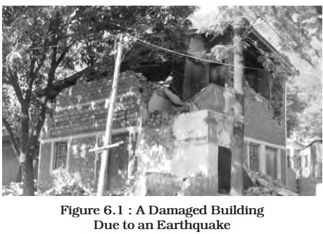
Earthquakes can have devastating consequences, including loss of life, property damage, and infrastructure disruption.

  • Effects of Earthquakes

The effects of earthquakes can vary depending on factors such as magnitude, location, and the vulnerability of the affected area.

  • Earthquake Hazard Mitigation

Measures can be taken to mitigate the impact of earthquakes, such as building codes, early warning systems, and emergency preparedness plans.

A visual of a damaged building from class 11 geography unit 1 chapter 6 - Natural Hazards and Disasters
image 706

Now, to understand tsunamis, let’s explore the section on tsunamis in the chapter “Natural Hazards and Disasters”.

Tsunami

Tsunamis are large-scale ocean waves caused by underwater earthquakes or volcanic eruptions.

Causes of Tsunami:

  • Undersea earthquakes.
  • Volcanic eruptions.
  • Landslides into the ocean.

Consequences of Tsunami:

  • Widespread flooding.
  • Destruction of coastal communities.
  • Loss of life and ecosystems.
image 708

Now, to understand tropical cyclones, let’s delve into the section on tropical cyclones in the chapter “Natural Hazards and Disasters”.

Tropical Cyclone

  • Tropical cyclones are intense low-pressure systems that form over warm ocean waters. 
  • They require specific conditions, including warm, moist air, strong Coriolis force, unstable atmospheric conditions, and the absence of strong vertical winds, to develop and intensify.

The key topics covered under this section are:

Spatio-Temporal Distribution of Tropical Cyclones in India:

  • Most occur in the Bay of Bengal.
  • Cyclones are common during pre-monsoon (May-June) and post-monsoon (October-November) periods.

Consequences of Tropical Cyclones:

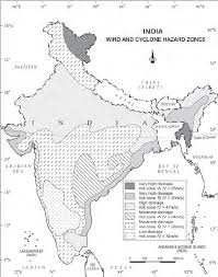
  • Strong winds causing structural damage.
  • Heavy rainfall leading to floods.
  • Storm surges causing coastal erosion.
image 706

Now, to grasp the effects of floods and their implications, let’s explore the section on floods in the chapter “Natural Hazards and Disasters”.

Floods

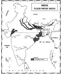
Floods occur when excessive rainfall or other factors lead to overflowing rivers or lakes.

Causes of Floods:

  • Excessive rainfall.
  • River overflow.
  • Dam failure.

Consequence and Control of Floods:

  • Damage to property and infrastructure.
  • Spread of water-borne diseases.
  • Flood control measures include dams, levees, and proper drainage systems.
image 707

Now, to understand droughts and their effects, let’s explore the section on droughts in the chapter “Natural Hazards and Disasters”.

Droughts

Droughts occur when there is a prolonged period of below-average rainfall.

The key topics that are included in this section are:

Types of Droughts

  • Meteorological drought (low precipitation).
  • Agricultural drought (soil moisture deficiency).
  • Hydrological drought (reduced water supply).

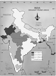
Drought Prone Areas in India:

  • Rajasthan, Gujarat, and parts of Maharashtra.

Consequences of Drought:

  • Crop failure and food shortages.
  • Water scarcity.
  • Migration and social unrest.
image 709

Now, to understand landslides and their impact, let’s delve into the section on landslides in the chapter ‘Natural Hazards and Disasters’.

Landslides

Landslides occur when soil or rock masses move downslope. The important topics under this section are:

Landslide Vulnerability Zones:

  • Himalayan region.
  • Western Ghats.
  • Northeastern India.

Consequences of Landslides:

  • Loss of life and property.
  • Disruption of transportation networks.
  • Environmental degradation.

Mitigation:

  • Afforestation and slope stabilization.
  • Construction of retaining walls.
  • Early warning systems.
image 710

Now, in order to understand how to manage natural disasters, let’s explore the section on disaster management in the chapter “Natural Hazards and Disasters”.

Disaster Management

  • Effective disaster management involves preparedness, response, recovery, and mitigation. 
  • This includes the development of early warning systems, public education, and the establishment of disaster response teams.

Finally, as we have gained comprehensive knowledge about the chapter “Natural Hazards and Disasters“, let’s reflect on the overall learning value of this important lesson.

Overall Learning Value of the Chapter:

India is vulnerable to a variety of natural hazards, which can have significant consequences for its population and economy. Understanding the causes, impacts, and mitigation strategies for these hazards is essential for building resilience and protecting communities.

Let’s Conclude

In conclusion, the chapter “Natural Hazards and Disasters” in Class 11 Geography provides an in-depth exploration of the various natural hazards that affect India. By studying this chapter, students gain valuable insights into the causes and consequences of disasters such as earthquakes, tsunamis, floods, droughts, and landslides. The chapter emphasizes the need for effective disaster management and mitigation strategies to minimize the impact of these hazards on society and the economy.

Through the comprehensive resources available on iPrep, including engaging animated videos and practice questions, learners can solidify their understanding of these crucial concepts. As we navigate the complexities of natural hazards and their ramifications, it’s imperative to foster awareness and preparedness. By doing so, we not only enhance our knowledge but also contribute to building resilient communities capable of withstanding the challenges posed by natural disasters.

Remember, the lessons learned in this chapter “Natural Hazards and Disasters” are vital not only for academic success in Class 11 Geography but also for fostering a deeper understanding of the world around us. Embrace the learning journey, and let’s ensure that the knowledge gained equips us for the future!

Practice questions on Chapter 6 - Natural Hazards and Disasters

Get your free Chapter 6 - Natural Hazards and Disasters practice quiz of 20+ questions & detailed solutions

Practice Now
Geography Unit 2

Chapter 6 - Natural Hazards and Disasters

Join iPrep Learning App

Download the App

Watch lectures, practice questions and take tests on the go.

Natural Vegetation – Complete Guide For Class 11 Geography Unit 2 Chapter 5

Welcome to iPrep, your Learning Super App. Our learning resources for the chapter, “Natural Vegetation” in Geography for Class 11th are designed to ensure that you grasp this concept with clarity and perfection. Whether you’re studying for an upcoming exam or strengthening your concepts, our engaging animated videos, practice questions and notes offer you the best of integrated learning with interesting explanations and examples.

As you engage with this chapter, you’ll discover not only the types of natural vegetation that flourish across India but also the intricate relationships between these ecosystems and the wildlife they support. The lessons within this chapter will guide you in understanding how various factors, such as climate, soil, and human activity, shape the distribution of these vital plant communities. This holistic approach will enhance your appreciation for the natural world and its critical role in sustaining life on our planet.

Objectives of Learning Natural Vegetation: A Study of India’s Forests

This chapter explores the diverse types of natural vegetation found in India, including forests, grasslands, and wetlands. It discusses the factors that influence the distribution of vegetation, the importance of forest conservation, and the challenges faced by wildlife in India.

Natural vegetation refers to the plant life that grows naturally in a particular region, without human intervention. India is home to a wide variety of natural vegetation, ranging from dense tropical rainforests to arid grasslands. This chapter delves into the different types of forests found in India, their characteristics, and the factors that influence their distribution.

Now that we have explored the importance of the chapter, let’s outline the objectives of studying it.

  • To understand the different types of forests found in India.
  • To explore the factors that influence the distribution of vegetation.
  • To analyze the importance of forest conservation in India.
  • To examine the challenges faced by wildlife in India.

Now let’s explore the various sections of the chapter.

Firstly, in order to understand the variety of forests in India, let’s delve into the Types of Forests section of the chapter “Natural Vegetation.”

Types of Forests

India’s forests can be classified into several types based on their characteristics and the dominant tree species.

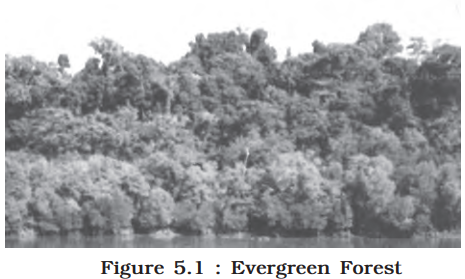
  • (i) Tropical Evergreen and Semi Evergreen forests
    • These forests are found in areas with high rainfall and warm temperatures.
    • They are characterized by tall, dense trees with evergreen leaves.
a visual of evergreen forest from class 11 geography chapter 5 - Natural Vegetation
  • (ii) Tropical Deciduous forests
    • These forests are found in regions with a distinct dry season.
    • The trees in these forests shed their leaves during the dry season.
image 702
  • (iii) Tropical Thorn forests
    • These forests are found in arid and semi-arid regions.
    • The trees in these forests have adapted to survive in dry conditions.
image 701
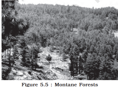
  • (iv) Montane forests
    • These forests are found in mountainous regions, with varying characteristics depending on altitude.
image 700
  • (v) Littoral and Swamp forests
    • These forests are found along coastlines and in swampy areas.
image 703

Now, in order to understand the importance of preserving forests, let’s explore the Forest Conservation section of the chapter “Natural Vegetation.”

Forest Conservation

Forest conservation is essential for maintaining ecological balance, protecting biodiversity, and providing various ecosystem services.

  • Social Forestry:
    • Social forestry involves planting trees on non-forest lands to meet the needs of local communities.
  • Farm Forestry:
    • Farm forestry involves planting trees on agricultural land to provide shade, fuel, and fodder.

Now, in order to understand the threats to wildlife, let’s delve into the Wildlife section of the chapter “Natural Vegetation.”

Wildlife

  • India has a rich diversity of wildlife, but human activities have led to habitat loss and declining populations of many species. Some species are now at the brink of extinction.
image 701

Important Reasons for Declining Wildlife

  • Habitat loss, poaching, pollution, and human-wildlife conflict are some of the major causes leading to the decline in wildlife populations in India.

Now, in order to understand the measures to protect wildlife, let’s explore the Wildlife Conservation in India section of the chapter “Natural Vegetation.”

Wildlife Conservation in India

  • India has implemented various measures to conserve wildlife, such as establishing national parks, wildlife sanctuaries, and tiger reserves.

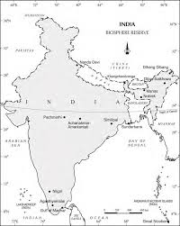
Biosphere Reserves

  • Biosphere reserves are areas designated for conserving biodiversity and promoting sustainable development. 
  • India has a network of biosphere reserves that protect ecologically sensitive areas.
image 704

Finally, as we have gained comprehensive knowledge about the chapter “Natural Vegetation“, let’s reflect on the overall learning value of this important lesson.

Overall Learning Value of the Chapter:

India’s natural vegetation is a valuable resource that plays a crucial role in the country’s ecology and economy. Conserving forests and protecting wildlife are essential for maintaining the health of India’s ecosystems and ensuring a sustainable future.

Let’s Conclude

In conclusion, CBSE Class 11th Geography Chapter on “Natural Vegetation” provides a thorough understanding of India’s diverse plant life and its distribution across various climatic regions. Through this chapter, students gain insights into the types of forests in India, including tropical, thorn, montane, and swamp forests, along with the unique ecosystems they support. The chapter emphasizes the significance of forest and wildlife conservation, exploring topics like social forestry, farm forestry, and the establishment of biosphere reserves. Studying CBSE Class 11th Geography Chapter “Natural Vegetation” equips students with a deeper awareness of the environmental importance of vegetation, helping them recognize the need to protect and sustain our natural resources.

By mastering the concepts in CBSE Class 11th Geography Chapter “Natural Vegetation,” students can appreciate India’s ecological diversity and understand the interconnectedness between natural vegetation, wildlife, and human impact. This chapter empowers learners to consider conservation efforts that ensure the survival and well-being of these invaluable resources for future generations.

Practice questions on Chapter 5 - Natural Vegetation

Get your free Chapter 5 - Natural Vegetation practice quiz of 20+ questions & detailed solutions

Practice Now
Geography Unit 2

Chapter 5 - Natural Vegetation

Join iPrep Learning App

Download the App

Watch lectures, practice questions and take tests on the go.

Climate – Complete Guide For Class 11 Geography Unit 2 Chapter 4

Welcome to iPrep, your Learning Super App. Our learning resources for the chapter, “Climate” in Geography for Class 11th are designed to ensure that you grasp this concept with clarity and perfection. Whether you’re studying for an upcoming exam or strengthening your concepts, our engaging animated videos, practice questions and notes offer you the best of integrated learning with interesting explanations and examples. 

With iPrep’s comprehensive resources for CBSE Class 11th Geography Chapter “Climate,” students can dive into the intriguing dynamics of weather and climate across India. The chapter “Climate” is designed to deepen your understanding of complex concepts, from monsoon patterns to seasonal variations, in an engaging and accessible way. With our tools, Class 11th students can build a strong foundation in Geography, making learning both enjoyable and effective.

Objectives Of Learning The Chapter – Climate

This chapter explores the diverse climate of India, focusing on the factors that influence its weather patterns and the impact of the monsoon on the country’s geography, economy, and society.

India’s climate is characterized by its unique monsoon system, which brings significant rainfall to the country during the summer months. This chapter delves into the factors that determine India’s climate, the nature of the monsoon, and the impact of climate change on the country’s weather patterns.

Now that we have explored the importance of the chapter, let’s outline the objectives of studying it.

  • To understand the factors that influence India’s climate.
  • To explore the nature and characteristics of the Indian monsoon.
  • To analyze the seasonal variations in India’s weather patterns.
  • To assess the impact of climate change on India’s climate.

Now let’s explore the various sections of the chapter.

Firstly, in order to understand the unity and diversity in India’s monsoon climate, let’s explore this introductory section of the chapter “Climate”.

Unity and Diversity in the Monsoon Climate

  • Despite its vast geographical extent, India experiences a relatively unified climate due to the influence of the monsoon. 
  • However, there is also significant regional variation in climate, depending on factors such as latitude, altitude, and proximity to the sea.

Now, to grasp the factors influencing India’s climate, let’s explore the Factors Determining the Climate of India section of the chapter “Climate.”

Factors Determining the Climate of India

Several factors contribute to India’s unique climate.

  • Latitude: 

India’s location between the Tropic of Cancer and the Tropic of Capricorn influences its tropical climate.

  • The Himalayan Mountains: 

The Himalayas act as a barrier, preventing cold air from entering India from the north.

  • Distribution of Land and Water: 

The distribution of land and water in India affects its climate, with coastal areas experiencing a more moderate climate than inland regions.

  • Distance from the Sea: 

Proximity to the sea influences temperature and rainfall patterns.

  • Altitude: 

Higher altitudes experience cooler temperatures and lower precipitation levels.

  • Relief: 

The topography of India, including its mountain ranges and plains, affects wind patterns and rainfall distribution.

  • InterTropical Convergence Zone (ITCZ): 

The ITCZ is a belt of low pressure that migrates north and south throughout the year, influencing India’s monsoon.

Now, in order to understand the nature of the Indian monsoon, let’s explore this section in the chapter “Climate”.

The Nature of the Indian Monsoon

The Indian monsoon is a unique meteorological phenomenon that brings significant rainfall to India during the summer months.

  • (i) The onset of the monsoon: The monsoon typically begins in early June and progresses northward.
  • (ii) Break in the monsoon: There are often periods of dry weather during the monsoon season, known as “breaks.”
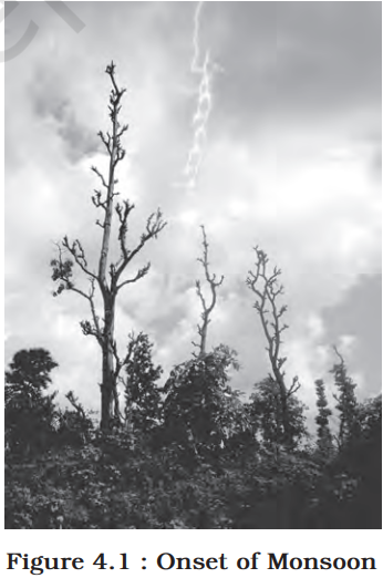
a visual of onset of monsoon from class 11 geography chapter 4 - Climate

Now, in order to understand India’s seasonal climate, let’s delve into the Rhythm of Seasons section of the chapter “Climate”.

The Rhythm of Seasons

India experiences four distinct seasons: the cold weather season, the hot weather season, the southwest monsoon season, and the retreating monsoon season.

  • The cold weather season: 

This season is characterized by cool temperatures, clear skies, and gentle winds. It occurs from November to February in most parts of India.

  • The hot weather season: 

This season is marked by high temperatures, dry conditions, and occasional heatwaves. It occurs from March to May in most parts of India.

  • The southwest monsoon season: 

This is the rainy season in India, brought about by the southwest monsoon winds. It occurs from June to September, with the heaviest rainfall occurring in central and northern India.

  • The retreating monsoon season: 

This season marks the gradual withdrawal of the monsoon winds, leading to a decrease in rainfall and a rise in temperatures. It occurs from October to November.

EI-Nino and the Indian Monsoon

The El Niño phenomenon can influence the strength and timing of the Indian monsoon.

image 695

Now, in order to understand India’s traditional seasons, let’s explore the Traditional Indian Seasons section of the chapter “Climate”.

Traditional Indian Seasons

In the Indian tradition, a year is divided into six two-monthly seasons. 

image 698

Now, in order to understand how rainfall is distributed across India, let’s explore the Distribution of Rainfall section of the chapter “Climate”.

Distribution of Rainfall

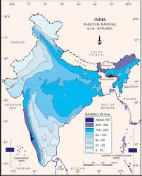
  • Overall, India experiences a wide range of rainfall patterns, with the highest rainfall occurring in the Western Ghats and northeastern regions, while the lowest rainfall is found in the western and southern parts of the country.
image 696

Now, in order to understand the impact of monsoons on economic life in India, let’s delve into this section of the chapter “Climate”.

Monsoons and the Economic Life in India

  • The monsoon is crucial for India’s agriculture, as it provides essential water for crops. 
  • However, variations in monsoon rainfall can lead to droughts, floods, and other challenges for agriculture.

Now, in order to understand the effects of global warming on India’s climate, let’s explore this section in the chapter “Climate”.

Global Warming

  • Global warming is caused by human activities, such as burning fossil fuels, which release greenhouse gasses into the atmosphere. 
  • This warming is leading to rising sea levels, changes in agricultural patterns, and increased risk of natural disasters.

Finally, as we have gained comprehensive knowledge about the chapter “Climate“, let’s reflect on the overall learning value of this important lesson.

Overall Learning Value of the Chapter:

India’s climate is characterized by its unique monsoon system and diverse regional variations. Understanding the factors that influence India’s climate is essential for effective planning and adaptation to climate change. The monsoon plays a crucial role in India’s economy and society, and its variability can have significant implications for agriculture, water resources, and human well-being.

Let’s Conclude

In conclusion, the chapter “Climate” in CBSE Class 11th Geography has offered us an in-depth understanding of India’s unique climate and the numerous factors that shape it. From exploring the diversity in monsoon patterns to understanding the implications of global warming, this chapter equips Class 11th students with essential knowledge on how climate impacts both the geography and economy of India. The “Climate” chapter not only explains the distinct seasonal cycles but also highlights how regional variations influence rainfall distribution and agricultural productivity. By mastering these concepts in Class 11th Geography, students are better prepared to appreciate the vital role of climate in shaping India’s natural and economic landscape.

Practice questions on Chapter 4 - Climate

Get your free Chapter 4 - Climate practice quiz of 20+ questions & detailed solutions

Practice Now
Geography Unit 2

Chapter 4 - Climate

Join iPrep Learning App

Download the App

Watch lectures, practice questions and take tests on the go.

Drainage System – Complete Guide For Class 11 Geography Unit 2 Chapter 3

Welcome to iPrep, your Learning Super App. Our learning resources for the chapter, “Drainage System” in Geography for Class 11th are designed to ensure that you grasp this concept with clarity and perfection. Whether you’re studying for an upcoming exam or strengthening your concepts, our engaging animated videos, practice questions and notes offer you the best of integrated learning with interesting explanations and examples. 

The “Drainage System” chapter in CBSE Class 11th Geography unravels the fascinating network of rivers and streams that shape India’s landscape. This chapter will guide you through the Himalayan and Peninsular drainage systems, their evolution, major river basins, and their vital roles in agriculture, transportation, and daily life.

Objectives of Learning The Chapter Drainage Systems of India

This chapter explores the intricate drainage systems of India, examining the Himalayan and Peninsular drainage systems. It delves into the evolution of these systems, the major rivers and their tributaries, and the extent of their usability for various purposes.

India’s diverse geography is reflected in its complex drainage systems, which play a crucial role in shaping the country’s landscape and supporting its population. This chapter provides a comprehensive overview of the drainage systems of India, focusing on the Himalayan and Peninsular regions.

Now that we have explored the importance of the chapter, let’s outline the objectives of studying it.

  • To understand the major drainage systems of India.
  • To explore the evolution of these drainage systems.
  • To analyze the characteristics and significance of the major rivers.
  • To assess the extent of usability of river water for various purposes.

Now let’s explore the various sections of the chapter.

Firstly, in order to understand the concept of drainage systems, let’s explore the introductory section of the chapter “Drainage System.”

The major points covered in this section are:

Drainage Patterns: India has two major drainage systems: the Himalayan drainage and the Peninsular drainage.

River Basins: The Himalayan drainage includes the Indus, Ganga, and Brahmaputra systems, while the Peninsular drainage includes rivers like the Narmada, Tapi, Krishna, and Kaveri.

Orientation: Most rivers flow eastward into the Bay of Bengal, while some, like the Narmada and Tapi, flow westward into the Arabian Sea.

Watersheds: Watersheds are the areas drained by rivers and their tributaries, and they play a crucial role in water management.

Drainage Basin Classification: Indian drainage basins are classified based on their size and orientation to the sea.

River Origins: Many rivers in India originate in the Himalayas or the Western Ghats.

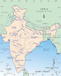
a visual of India map from the chapter drainage system from class 11 geography

Now, in order to understand the significance of the Himalayan drainage system, let’s delve into the section “The Himalayan Drainage” of the chapter “Drainage System.”

The Himalayan Drainage

  • The Himalayan drainage system is characterized by its perennial rivers, which originate in the Himalayas and flow eastward into the Bay of Bengal.

The key points covered under this topic are discussed below:

Evolution of the Himalayan Drainage

  • The Himalayan drainage system has evolved over millions of years due to tectonic activity.
  • The uplift of the Himalayas created a steep gradient for the rivers, leading to their rapid flow and erosion.
image 694

The River Systems of the Himalayan Drainage

The Himalayan drainage system comprises three major river systems: the Indus, the Ganga, and the Brahmaputra.

  • The Indus System
    • The Indus River originates in Tibet and flows westward through Pakistan and India.
    • It is an important source of water for agriculture and irrigation in the Indus Valley.
  • The Ganga System
    • The Ganga River is one of the most important rivers in India, both culturally and economically.
    • It flows eastward through northern India and Bangladesh, eventually emptying into the Bay of Bengal.
  • The Brahmaputra System
    • The Brahmaputra River originates in Tibet and flows eastward through India, Bangladesh, and Myanmar.
    • It is known for its wide and braided channels, and is an important source of water for agriculture and transportation.

Now, in order to understand the distinct characteristics of the peninsular drainage, let’s delve into the section “The Peninsular Drainage System.”

The Peninsular Drainage System

The Peninsular drainage system is characterized by its seasonal rivers, which are fed by rainfall during the monsoon season.

  • The Evolution of Peninsular Drainage System

The Peninsular drainage system has been influenced by geological processes and tectonic activity.The Deccan Plateau, which forms the southern part of the Indian subcontinent, has a unique drainage pattern.

  • River Systems of the Peninsular Drainage

The Peninsular drainage system includes several major rivers, such as the Narmada, Tapi, Krishna, Kaveri, and Godavari.

  • Extent of Usability of River Water
    • The rivers of India are vital sources of water for agriculture, irrigation, drinking, and industrial purposes.
    • However, the availability and quality of river water are subject to various factors, including rainfall, pollution, and over-extraction.

Finally, as we have gained comprehensive knowledge about the chapter “Drainage System”, let’s reflect on the overall learning value of this important lesson.

Overall Learning Value

The drainage systems of India are essential for the country’s economic and social development. Understanding the characteristics, evolution, and extent of usability of these river systems is crucial for effective water resource management and sustainable development.

Let’s Conclude

In conclusion, the “Drainage System” chapter in Class 11th Geography offers invaluable insights into India’s diverse and complex river systems. By exploring both the Himalayan and Peninsular drainage systems, you’ve gained an understanding of their origins, major rivers, and significance to India’s geography, agriculture, and water resource management. The knowledge of the drainage system in Class 11th Geography provides foundational understanding, essential for appreciating India’s unique physical landscape and the sustainable management of its water resources.

As you progress with the “Drainage System” chapter, revisit key sections, review the provided resources on iPrep, and test your understanding through interactive practice to solidify your grasp of this important Class 11th topic. This comprehensive learning approach will ensure you’re well-prepared for exams and able to apply this knowledge beyond the classroom.

Practice questions on Chapter 3 - Drainage System

Get your free Chapter 3 - Drainage System practice quiz of 20+ questions & detailed solutions

Practice Now
Geography Unit 2

Chapter 3 - Drainage System

Join iPrep Learning App

Download the App

Watch lectures, practice questions and take tests on the go.

Structure and Physiography – Complete Guide For Class 11 Geography Unit 2 Chapter 2

Welcome to iPrep, your Learning Super App. Our learning resources for the chapter, “Structure and Physiography” in Geography for Class 11th are designed to ensure that you grasp this concept with clarity and perfection. Whether you’re studying for an upcoming exam or strengthening your concepts, our engaging animated videos, practice questions and notes offer you the best of integrated learning with interesting explanations and examples.

The “Structure and Physiography” chapter in CBSE Class 11th Geography provides a fascinating look at the natural foundation of India’s landscape. Through this chapter, students dive into the geological evolution and varied physical features that characterize the Indian subcontinent. From the majestic Himalayas to the expansive Indo-Gangetic plains, each region reveals a unique story shaped by millions of years of geological activity. This chapter not only broadens students’ understanding of India’s physical geography but also highlights the critical role these landscapes play in the nation’s climate, biodiversity, and human settlement patterns.

Objectives Of Learning – Structure and Physiography of India

This chapter explores the geological structure and physical features of India, examining the major regions and their unique characteristics. It delves into the formation of the Indian subcontinent, the geological processes that have shaped its landscape, and the diverse physical features found across the country.

India is a geographically diverse country with a wide range of physical features, from towering mountains to vast plains and coastal regions. This chapter provides a comprehensive overview of the geological structure and physiography of India, examining the key regions and their characteristics.

Now that we have explored the importance of the chapter, let’s outline the objectives of studying it.

  • To understand the geological structure of India.
  • To explore the major physiographic regions of India.
  • To analyze the characteristics and significance of each region.

Now let’s explore the various sections of the chapter.

Firstly, in order to understand the geological diversity of India, let’s delve into the section ‘Geological Regions’ of the chapter ‘Structure and Physiography’.

Geological Regions

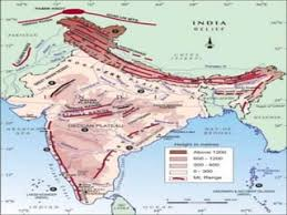
This section outlines the major geological divisions that have shaped the Indian subcontinent. India can be divided into three major geological regions: the Peninsular Block, the Himalayas and other Peninsular Mountains, and the Indo-Ganga-Brahmaputra Plain.

Let’s understand these divisions in detail.

  • (i) The Peninsular Block
    • The Peninsular Block is the oldest geological region in India, formed by Precambrian rocks.

Features:

  • Oldest landmass, with rich mineral resources.
  • Stable block with low seismic activity.
  • (ii) The Himalayas and other Peninsular Mountains
    • The Himalayas are the world’s highest mountain range, formed due to the collision of tectonic plates.
    • Other Peninsular Mountains include the Aravallis, Vindhyas, and Satpuras.

Features:

  • Home to the highest peaks in the world, including Mount Everest.
  • Significant for their impact on climate and as a source of major rivers.
  • (iii) Indo-Ganga-Brahmaputra Plain
    • The Indo-Ganga-Brahmaputra Plain is a vast alluvial plain formed by the deposition of sediments by the rivers.

Features:

  • Fertile agricultural land, supporting a dense population.
  • Prone to floods but crucial for India’s agriculture.

Now, in order to understand the physical features of India, let’s delve into the section ‘Physiography’ of the chapter ‘Structure and Physiography’.

Physiography

India’s physiography is characterized by its diverse landscapes, which have been shaped by geological processes over millions of years.

  • (1) The Northern and North-eastern Mountains
    • This region includes the Himalayas, which are divided into three ranges—the Himadri, Himachal, and Shiwaliks.
    • The Himalayas are the highest mountain range in the world, with peaks reaching over 8,000 meters.
    • The northeastern mountains include the Karakoram, Hindu Kush, and Naga Hills.

Features:

  • Acts as a climatic barrier, influencing monsoon patterns.
  • Source of perennial rivers like the Ganges and Brahmaputra.
image 688
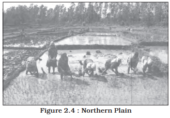
  • (2) The Northern Plain
    • The Northern Plain is a vast alluvial plain formed by the deposition of sediments by the Indus, Ganga, and Brahmaputra rivers.
    • Extending from the Punjab Plain in the west to the Assam Valley in the east, this is one of the most fertile and densely populated regions in India.

Features:

  • Formed by alluvial deposits from the Himalayan rivers.
  • Crucial for agriculture, particularly rice and wheat cultivation.
image 692
  • (3) The Peninsular Plateau
    • The Peninsular Plateau is a large plateau region formed by ancient crystalline rocks.
    • It is further divided into the Deccan Plateau, the Central Highlands, and the Northeastern Plateau.

The Deccan Plateau:
A large plateau making up most of southern India, characterized by its black soil, ideal for cotton cultivation.

The Central Highlands:
Located to the north of the Deccan Plateau, this region is known for its rich biodiversity and mineral wealth.

The Northeastern Plateau:
Known for its rich coal deposits, this plateau is an extension of the Chotanagpur Plateau.

image 689
  • (4) The Indian Desert
    • The Indian Desert, also known as the Thar Desert, is a vast arid region in western India.

Features:

  • Characterized by arid climate, sandy terrain, and sparse vegetation.
  • Supports unique desert flora and fauna.
image 690
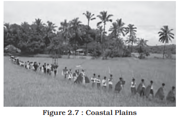
  • (5) The Coastal Plains
    • The coastal plains of India are narrow strips of land along the Arabian Sea and the Bay of Bengal.

Features:

  • The Western Coastal Plain is narrow and fertile.
  • The Eastern Coastal Plain is broader and marked by river deltas.
image 691
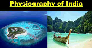
  • (6) The Islands
    • India has several islands, including the Andaman and Nicobar Islands and the Lakshadweep Islands.

Features:

  • Volcanic origin in the Andaman and Nicobar group.
  • Coral atolls in the Lakshadweep group.
image 687
image 690

Finally, as we have gained comprehensive knowledge about the chapter “Structure and Physiography”, let’s reflect on the overall learning value of this important lesson.

Overall Learning Value of the Chapter

The chapter “Structure and Physiography” offers a comprehensive understanding of India’s physical landscape. By studying this chapter, students gain insight into how India’s diverse geological and physiographic features have influenced its climate, biodiversity, and human settlement patterns. This knowledge is crucial for understanding India’s natural resources, environmental challenges, and the role of geography in shaping the nation’s history and development.

Let’s Conclude

In conclusion, CBSE Class 11th Geography Chapter “Structure and Physiography” equips students with an in-depth understanding of India’s geological and physical landscape. Through this chapter, learners explore the diverse regions that make up India’s physiography, from the towering Himalayas to the fertile Northern Plains and the arid Indian Desert. With these insights, students appreciate how the “Structure and Physiography” of Class 11th Geography influences climate, biodiversity, and resource distribution across the nation. By mastering this chapter, students build a solid foundation in physical geography, which is essential for understanding broader environmental issues and India’s unique geographical characteristics.

The chapter “Structure and Physiography” for Class 11th Geography is a gateway to discovering how physical features have shaped cultural, economic, and historical aspects of India, making it an invaluable component of their academic journey.

Practice questions on Chapter 2 - Structure and Physiography

Get your free Chapter 2 - Structure and Physiography practice quiz of 20+ questions & detailed solutions

Practice Now
Geography Unit 2

Chapter 2 - Structure and Physiography

Join iPrep Learning App

Download the App

Watch lectures, practice questions and take tests on the go.

India-Location – Complete Guide For Class 11 Geography Unit 2 Chapter 1

Welcome to iPrep, your Learning Super App. Our learning resources for the chapter, “India-Location” in Geography for Class 11th are designed to ensure that you grasp this concept with clarity and perfection. Whether you’re studying for an upcoming exam or strengthening your concepts, our engaging animated videos, practice questions and notes offer you the best of integrated learning with interesting explanations and examples. 

India’s geographical location is pivotal not only to its own development but also to its interactions on a global scale. In CBSE Class 11th Geography Chapter – India-Location, you’ll explore how India’s size and strategic position influence its climate, biodiversity, and relationships with neighboring countries. This chapter is designed to give you a well-rounded perspective on the importance of India’s unique place in the world.

Objectives of Learning the Chapter – India: Location

This chapter provides an overview of India’s geographical location, its size, and its relationship with neighboring countries. It explores the significance of India’s position in the world and its interactions with other nations.

India is a vast and diverse country located in South Asia. Its geographical location has played a significant role in its history, culture, and economic development. This chapter delves into the key aspects of India’s location, including its size, its neighbors, and its geopolitical significance.

Now that we have explored the importance of the chapter, let’s outline the objectives of studying it.

  • To understand India’s geographical location.
  • To explore the size and extent of India’s territory.
  • To identify India’s neighboring countries.
  • To analyze the geopolitical significance of India’s location.

Now let’s explore the various sections of the chapter.

Firstly, in order to understand the geographical significance and expanse of India, let’s delve into the section ‘Size’ of the chapter ‘India-Location.’

Size

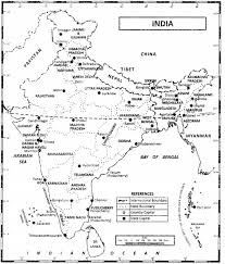
India is the seventh-largest country in the world by land area. India’s vast expanse covers 3.28 million square kilometers, making it the seventh-largest country in the world. The size of India has a direct impact on its climate, biodiversity, and cultural diversity.

  • Geographical Extent:
    • India stretches from the Himalayas in the north to the Indian Ocean in the south.
    • It is bordered by several countries, including Pakistan, China, Nepal, Bhutan, Bangladesh, Myanmar, and Sri Lanka.
A visual representation of the India map
image 686

Now, in order to understand India’s geopolitical significance, let’s delve into the section on “India and Its Neighbours” in the chapter “India-Location.”

India and Its Neighbors

India’s location has influenced its interactions with neighboring countries.

  • Neighboring Countries:
    • India shares borders with Pakistan, China, Nepal, Bhutan, Bangladesh, Myanmar, and Sri Lanka.
    • These neighboring countries have played a significant role in India’s history and foreign policy.

Finally, as we have gained comprehensive knowledge about the chapter “India-Location”, let’s reflect on the overall learning value of this important lesson.

Overall Learning Value

The chapter “India-Location” provides a comprehensive overview of India’s geographical positioning, highlighting its size, latitudinal and longitudinal extent, and relationships with neighboring countries. Understanding India’s location is essential for grasping its climate diversity, cultural richness, and strategic importance in the global context. The insights gained from this chapter emphasize the significance of geography in shaping the destiny of a nation.

Let’s Conclude

In conclusion, CBSE Class 11th Geography Chapter – India-Location offers an invaluable understanding of India’s unique geographical positioning, size, and its relationships with neighboring nations. Through iPrep’s comprehensive learning resources for Class 11th Geography Chapter – India-Location, students can explore the impact of India’s location on its climate, culture, and strategic influence in the global arena. Grasping these concepts in India-Location for Class 11th equips learners with insights into the vital role geography plays in shaping a nation’s identity and interactions. As you move forward, continue to use these resources to strengthen your understanding and appreciation of India’s position on the world stage, making your journey through CBSE Class 11th Geography Chapter – India-Location both enlightening and rewarding.

Practice questions on Chapter 1 - India: Location

Get your free Chapter 1 - India: Location practice quiz of 20+ questions & detailed solutions

Practice Now
Geography Unit 2

Chapter 1 - India: Location

Join iPrep Learning App

Download the App

Watch lectures, practice questions and take tests on the go.

Paths to Modernization – Complete Guide For Class 11 History Chapter 7

Welcome to iPrep, your Learning Super App. Our learning resources for the chapter, “Paths to Modernization” in History for Class 11th are designed to ensure that you grasp this concept with clarity and perfection. Whether you’re studying for an upcoming exam or strengthening your concepts, our engaging animated videos, practice questions and notes offer you the best of integrated learning with interesting explanations and examples. 

Objectives Of Learning Paths to Modernization: A Comparative Study of East Asian Nations

This chapter explores the diverse paths taken by East Asian nations in their quest for modernization during the 19th and 20th centuries. It examines the impact of Western influence, traditional responses, and internal factors on the modernization processes of Japan, China, Korea, and Taiwan.

The 19th and 20th centuries witnessed a transformative period for East Asian nations, as they grappled with the challenges and opportunities presented by Western modernity. This chapter delves into the diverse paths taken by Japan, China, Korea, and Taiwan in their quest for modernization, examining the factors that shaped their development and the enduring legacies of their experiences.

Now that we have explored the importance of the chapter, let’s outline the objectives of studying it.

  • To understand the historical context of East Asian modernization.
  • To explore the impact of Western influence on East Asian societies.
  • To examine the responses of traditional elites and social movements to Western modernity.
  • To analyze the modernization processes of Japan, China, Korea, and Taiwan.
  • To compare and contrast the different paths taken by these nations.

Now let’s explore the various sections of the chapter.

Firstly, in order to understand the early efforts toward modernization, let’s delve into the “Introductory” section of the chapter “Paths to Modernization.”

Introduction:

  • The encounter with Western powers in the 19th century posed significant challenges and opportunities for East Asian nations.
  • These challenges included military defeat, economic exploitation, and cultural imperialism, while opportunities included access to new technologies, knowledge, and ways of organizing society.
Paths to Modernization

Now, to gain insight into Japan’s journey towards modernization, let’s explore the “Japan: The Meiji Restoration” section of the chapter “Paths to Modernization.”

Japan: The Meiji Restoration

Introduction

The Meiji Restoration in Japan marked a turning point in the country’s modernization process.

Now, lets explore the key points covered under this topic.

The Political System

  • The Meiji government established a centralized and bureaucratic political system, abolishing feudal domains and implementing a new legal system based on Western models.

The Meiji Reforms

  • The Meiji government implemented a series of reforms to modernize Japan’s economy, society, and military. 
  • These included the abolition of the feudal system, the establishment of a public education system, and the creation of a modern army and navy.
image 683

Modernizing the Economy

  • Japan’s economic modernization was driven by industrialization and technological innovation.
  • The Meiji government promoted the development of heavy industries such as steel, shipbuilding, and textiles, while also investing in education and scientific research to foster technological advancement.

Industrial Workers

  • The rise of industrialization led to the emergence of a new class of industrial workers.
  • The growth of the industrial working class contributed to the development of labor unions and social movements, as workers sought better wages, working conditions, and rights.
image 684

Aggressive Nationalism

  • Japan’s modernization was accompanied by an aggressive foreign policy and expansionist ambitions.
  • This aggressive foreign policy ultimately led to conflict with neighboring powers and culminated in Japan’s involvement in World War II.AD 4nXcWApjB6T1Lqox8QV4QjxuanUSC3jv7rm4e9fwlybcs2L0mPYHx7M6EuMu1MfVwZmYjbJWPEs cPTaVon7RwLFhatdSj Tw6irqhPrRwqAxIvf6qE6k6hWvmI9qXHgv2O3KECOvHEwaT8oDzLeU8F OLA?key=NDuP05BxHI3ULf FlInIwQ  AD 4nXdckYDoA3SDjsoWyKTMxV1uWUY5S8lsFzwVIAN4PxHNbW0kPh394A1zb9XP9gbY aQTbtgDXuJm8BY0NGPl59T4RTZ0sKMOX s4Dq9xhAInimoVfN4Me8Uzk0K56NuS6ce3kN3XSZeNNmbNv3WrnMX3X65a?key=NDuP05BxHI3ULf FlInIwQ

‘Westernisation’ and ‘Tradition’

  • The debate over the extent of Westernization and the preservation of traditional values continued in Japan.
  • This led to a complex and often conflicting debate about the appropriate balance between modernity and tradition.

Daily Life

  • Modernization brought significant changes to daily life in Japan.
  • The introduction of Western technologies, such as railways, telegraphs, and factories, transformed the way people lived and worked.
image 680

‘Overcoming Modernity’

  • While many embraced the benefits of modernization, such as economic growth and technological advancement, others were concerned about the potential loss of traditional values and cultural identity. 
  • Some Japanese intellectuals and cultural figures advocated for a more selective approach to Westernization, emphasizing the importance of preserving Japanese traditions while adopting those aspects of Western culture that were deemed beneficial.

After Defeat: Re-emerging as a Global Economic Power

  • Despite its defeat in World War II, Japan experienced a remarkable economic recovery and became a global economic power.
  • With the support of the United States, Japan was able to rebuild its economy and achieve rapid economic growth.

Now, to better understand China’s quest for modernity, let’s explore the “China: The Search for Modernity” section of the chapter “Paths to Modernization.”

China: The Search for Modernity

China’s path to modernization was marked by internal struggles and external pressures.

Let’s explore the key points covered under this topic.

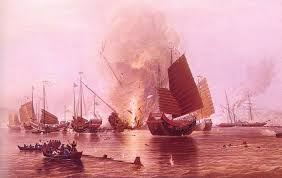
The Opium Trade

  • The East India Company engaged in triangular trade between Britain, India, and China. 
  • They sold opium in China, using the silver earned to buy Chinese goods for sale in Britain. 
  • This created a serious balance-of-trade problem as Western goods were not popular in China.
image 681

The Search for Modernity:

  • Chinese intellectuals and reformers sought to modernize China while preserving its cultural heritage.
  • This led to a complex and often conflicting debate about the appropriate balance between tradition and modernity.

Establishing the Republic

  • The establishment of the Republic of China in 1911 marked a significant turning point in Chinese history.
  • The establishment of the republic was a culmination of years of anti-imperialist and revolutionary movements, inspired by Western ideas of democracy and nationalism. 
  • However, the Republic of China faced numerous challenges, including political instability, economic difficulties, and the threat of foreign intervention.

The Rise of the Chinese Communist Party:

  • The Chinese Communist Party emerged as a powerful force in Chinese politics.
  • Founded in 1921, the CCP gained strength through its grassroots organization, revolutionary ideology, and ability to mobilize the peasantry. 
  • The CCP’s influence grew during the Chinese Civil War, and it ultimately defeated the Nationalist Party in 1949, establishing the People’s Republic of China.
image 680

Establishing the New Democracy: 1949-65

  • The Communist Party’s victory in the Chinese Civil War led to the establishment of the People’s Republic of China.
  • The establishment of the PRC had profound implications for China’s domestic and foreign affairs, as well as for the global balance of power.

Conflicting Visions: 1965-78

  • Mao Zedong’s policies, such as the Great Leap Forward and the Cultural Revolution, had mixed results.
  • The Great Leap Forward, launched in 1958, resulted in widespread famine and economic hardship. 
  • The Cultural Revolution, which began in 1966, led to political turmoil, violence, and the destruction of cultural heritage. 
  • Despite their negative consequences, these policies also had some positive effects, such as mobilizing the population and fostering a sense of national unity.

Reforms from 1978

  • Deng Xiaoping’s economic reforms ushered in a new era of modernization for China.
  • These reforms led to rapid economic growth and transformed China into a global economic powerhouse.
image 682

Now, to understand Taiwan’s journey toward modernization, let’s explore “The Story of Taiwan” section of the chapter “Paths to Modernization.”

The Story of Taiwan

  • Taiwan’s modernization was influenced by its unique historical and geopolitical circumstances.
  • As an island off the coast of mainland China, Taiwan has faced a complex relationship with its larger neighbor. 
  • After the Chinese Civil War in 1949, the Nationalist government retreated to Taiwan, establishing the Republic of China. 
  • Since then, Taiwan has developed as a separate political entity, facing challenges related to its sovereignty and security. 
  • Despite these challenges, Taiwan has achieved significant economic and social development, becoming a model of modernization in East Asia.

Now, to gain a better understanding of Korea’s modernization, let’s explore “The Story of Korea” section of the chapter “Paths to Modernization.”

The Story of Korea

Korea’s modernization was shaped by its division into North and South Korea.

Beginnings of Modernisation

  • Both North and South Korea embarked on modernization efforts after the Korean War.
  • However, the two countries followed very different paths, reflecting their contrasting political ideologies and geopolitical circumstances. North Korea pursued a centrally planned socialist economy and a totalitarian political system, while South Korea adopted a market-oriented economy and a democratic political system. 
  • These divergent paths led to significantly different outcomes in terms of economic development, social welfare, and human rights.
image 681

A Post-War Nation

  • South Korea faced significant challenges after the Korean War, including economic devastation and the threat of North Korean aggression. 
  • Despite these obstacles, the country implemented successful economic reforms that led to rapid development and prosperity.

Rapid Industrialisation under Strong Leadership

  • South Korea’s economic development was driven by strong leadership, government intervention, and a focus on export-oriented industries.
  • The South Korean government played a central role in guiding the country’s economic development, implementing policies that promoted industrialization, investment, and exports. 
  • This approach led to rapid economic growth and transformed South Korea into a global economic powerhouse.

Continued Economic Growth and Calls for Democratisation

  • South Korea’s economic success was accompanied by growing calls for political liberalization and democracy.
  • The authoritarian government faced increasing pressure to democratize, and in the late 1980s and early 1990s, South Korea underwent a peaceful transition to democracy. 
  • This marked a significant milestone in the country’s political development and solidified its reputation as a model of economic and political modernization in East Asia.

Korean Democracy and the IMF Crisis

  • The Asian financial crisis of 1997 posed a major challenge to South Korea’s economic and political development.
  • The crisis also served as a catalyst for further political and economic reforms, as South Korea sought to strengthen its resilience and competitiveness in the global economy.

Two Roads to Modernisation

  • The experiences of Japan, China, Korea, and Taiwan demonstrate the diversity of paths taken by East Asian nations in their quest for modernization.
  • Each country faced unique historical, cultural, and geopolitical circumstances that shaped its modernization process.
  • These diverse experiences highlight the complexity and challenges of modernization in East Asia and offer valuable lessons for other developing nations.
image 681

Finally, as we have gained comprehensive knowledge about the chapter “Paths to Modernization”, let’s reflect on the overall learning value of this important lesson.

Overall Learning Experiences

The modernization of East Asian nations was a complex and multifaceted process, shaped by a variety of factors, including Western influence, traditional responses, internal struggles, and external pressures. While each nation followed its own unique path, they all shared a common goal of building modern, prosperous, and powerful societies. The experiences of these nations offer valuable insights into the challenges and opportunities of modernization in the contemporary world.

Let’s Conclude

In conclusion, the journey through CBSE Class 11th History Chapter “Paths to Modernization” offers a rich understanding of how Japan, China, Korea, and Taiwan each navigated unique paths to modernity. As you have seen, each nation’s experience was shaped by a blend of Western influences, cultural traditions, and internal dynamics. The chapter “Paths to Modernization” for Class 11th History enables students to grasp these intricate histories and compare how each country’s strategy led to different outcomes in modernization.

Studying “Paths to Modernization” for Class 11th not only broadens historical knowledge but also provides critical insights into the broader socio-political transformations in East Asia. Through iPrep’s resources, from animated videos to comprehensive notes, students can engage deeply with the themes of this chapter, making CBSE Class 11th History Chapter “Paths to Modernization” both engaging and educational.

Practice questions on Chapter 7 - Paths to Modernization

Get your free Chapter 7 - Paths to Modernization practice quiz of 20+ questions & detailed solutions

Practice Now
History

Chapter 7 - Paths to Modernization

Join iPrep Learning App

Download the App

Watch lectures, practice questions and take tests on the go.