Mapping Your Way – Complete Guide For Class 5 Math Chapter 8
Welcome to iPrep, your Learning Super App. Our learning resources for the chapter, Mapping Your Way in Mathematics for Class 5th are designed to ensure you grasp this concept with clarity and perfection. Whether studying for an upcoming exam or strengthening your concepts, our engaging animated videos, practice questions and notes offer you the best-integrated learning with interesting explanations and examples.
This chapter Mapping Your Way introduces students to the fundamental concepts of maps and directions. Through engaging stories and practical activities, students learn to interpret maps, understand scales, and navigate using directions. The chapter uses real-life examples, such as exploring India Gate and Red Fort, to make learning relatable and fun. Students practice calculating distances, identifying landmarks, and understanding the layout of different areas. By exploring these spatial relationships, students develop a deeper understanding of geography, enhancing their problem-solving skills and spatial awareness. Dive into the world of maps and discover the art of navigation with this exciting chapter!
Mapping Your Way: A Journey Through Maps and Directions
This chapter of Mapping Your Way, takes us on an exciting journey, exploring maps, understanding directions, and discovering how to interpret various locations.
Let’s go further into understanding the concept of mapping your way dive into the fascinating world of maps and learn how to navigate through them!
A Trip to India Gate
Ashi is thrilled as she heads to the Republic Day Parade at India Gate with her schoolmates. They hear about the significance of India Gate, built in memory of Indian soldiers who died in the First World War.
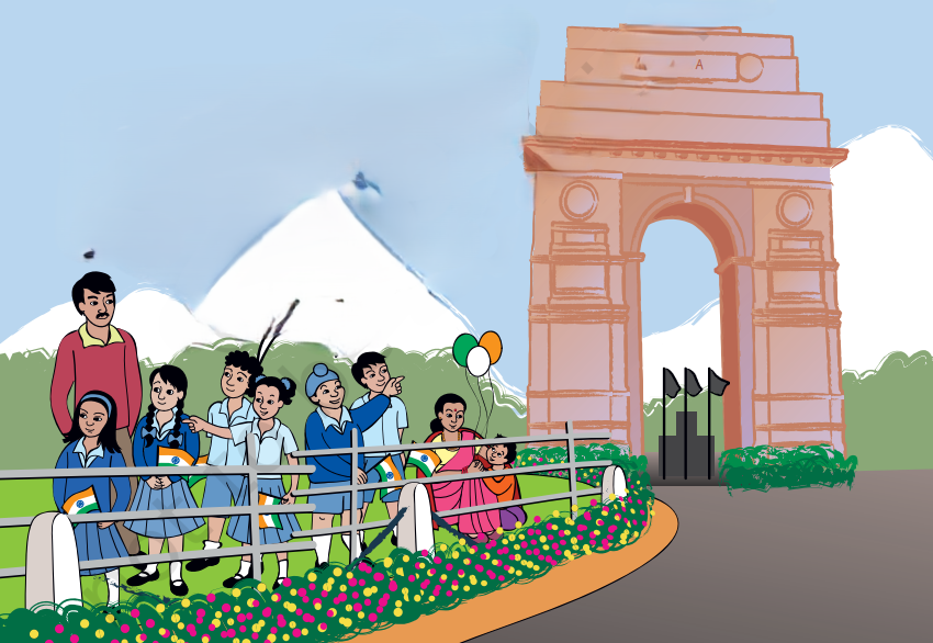
As the children settle down, they start noticing the buildings around them, including Rashtrapati Bhawan, which faces India Gate.
Exploring the Map
Let’s go further into understanding the meaning of Mapping your way by exploring the map from Rashtrapati Bhawan to India Gate. Look at the map and match it with the photo of the city. Identify roads and buildings, and trace the route from Rashtrapati Bhawan to India Gate.
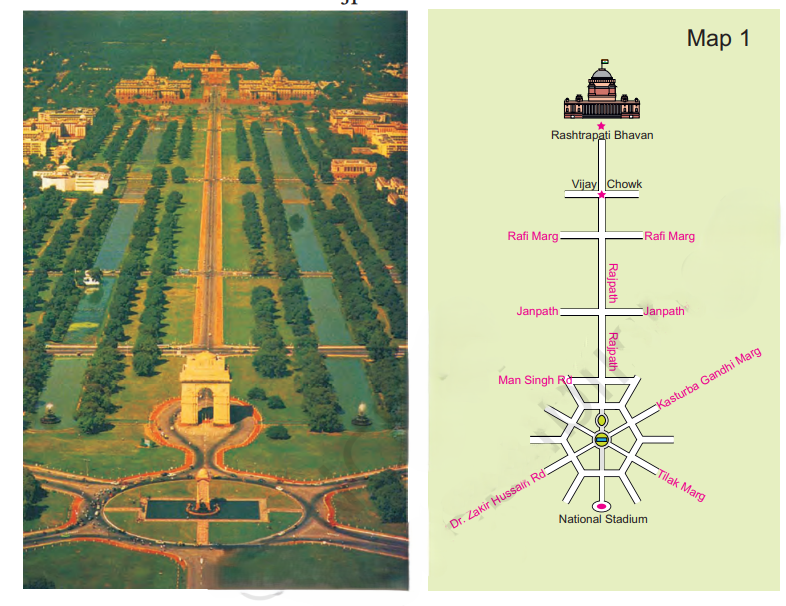
Find landmarks like the National Stadium on the map and in the photo.
The Central Hexagon
The central hexagon of the India gate also gives a good understanding of Mapping Your Way. Zoom into the map to observe the Central Hexagon, a prominent feature with six sides.
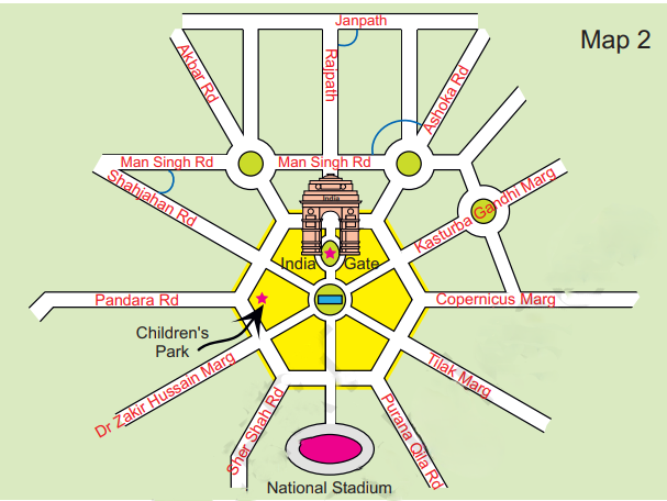
Notice the roads and their angles around the Central Hexagon. Identify which roads intersect at right angles and figure out the placement of landmarks like Children’s Park about Rajpath and India Gate.
The Parade Route
Going further into understanding the concept of mapping your way, let’s see what the parade route near India Gate Looks like.
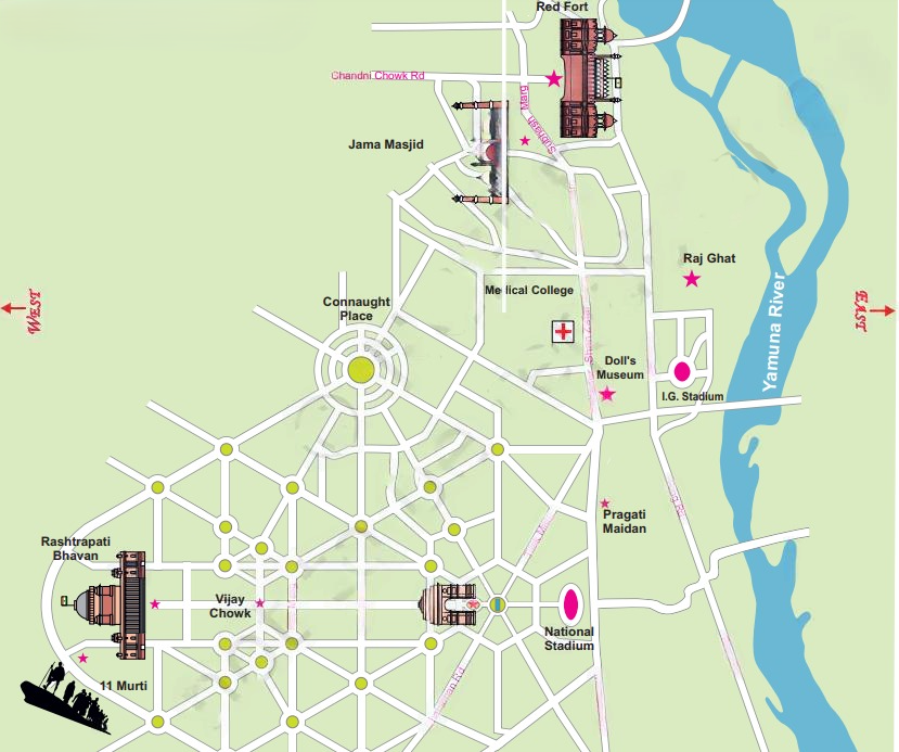
As the children watch the parade, they discuss the route from Vijay Chowk to Red Fort. They trace this route on the map, marking key points like India Gate and Rajpath. They calculate distances using the map’s scale, learning how 2 cm on the map represents 1 km on the ground.
A Visit to Red Fort
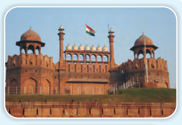
Follow the children as they explore the Red Fort, starting from Lahori Gate and passing through Meena Bazar.
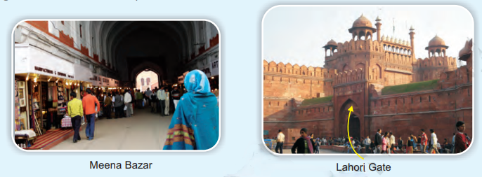
Learn about the significant buildings within the fort, like Diwan-e-Aam and Diwan-e-Khaas, and their proximity to the Yamuna River.
Make It Bigger, Make It Smaller – Understanding Scale
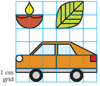
Understand the importance of scale in maps. When showing a large area on paper, it’s essential to reduce it by a fixed ratio to maintain relative distances and positions.

Practice enlarging and reducing pictures on different grid sizes to grasp the concept of scale.
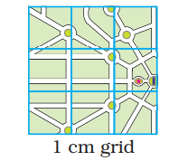
We can understand this
- 1 cm on map = 1 km on ground
- 1/2 cm on map = 1 km on ground
- 2 cm on map = 1 km on ground
Directions and Distance
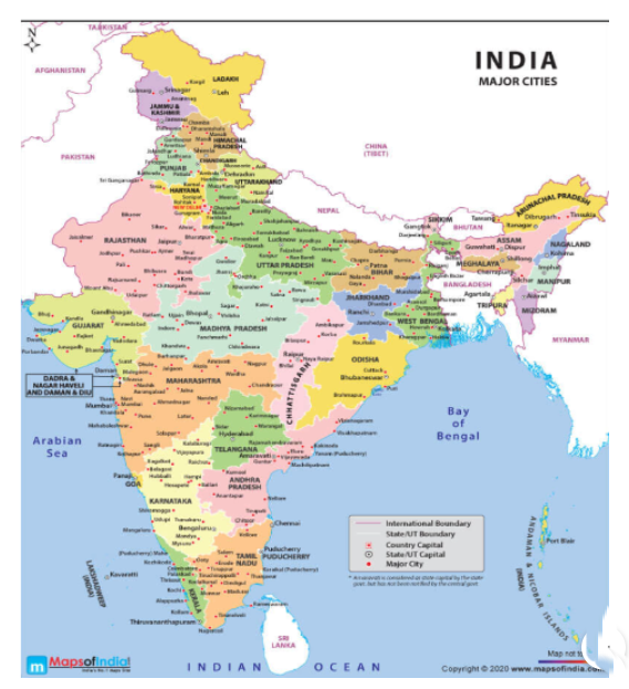
Learn about directions and how to determine them using a map.
For instance, figure out which states are crossed when traveling north from Karnataka to Delhi or south from Jammu and Kashmir to Delhi.
Estimate distances between cities using the map’s scale.
We can also mark those states which have the sea on one side.
Town Distances
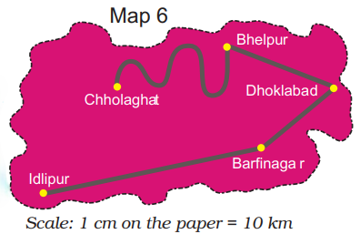
Calculate distances between towns on a map using a given scale.
Mark midway points, find towns equidistant from two locations and measure route lengths with a thread.
Ashi’s School Map
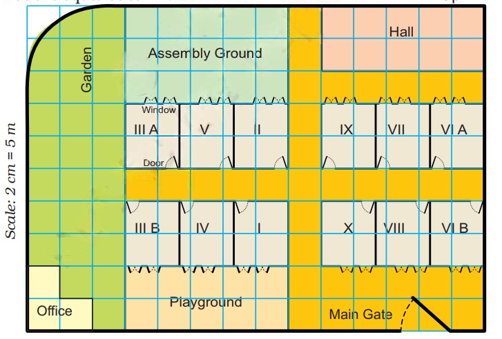
Examine a map of Ashi’s school to understand the layout and relative sizes of different areas.
Determine the area of the assembly ground compared to the office, and identify the placement of classroom elements like the blackboard and notice board.
Conclusion
In conclusion, CBSE Class 5th Math, Chapter 8 – Mapping Your Way opens up a fascinating world of maps and navigation. Through practical examples like exploring India Gate, Red Fort, and even Ashi’s school map, students gain valuable skills in reading maps, calculating distances, and understanding directions. This chapter not only strengthens geographical knowledge but also enhances problem-solving and spatial reasoning abilities. As you complete Chapter 8 – Mapping Your Way, you’ll feel more confident in navigating the world around you, both on paper and in real life! So, keep practicing and mastering the skills learned in Mapping Your Way!
Practice questions on Chapter 8 - Mapping Your Way
Get your free Chapter 8 - Mapping Your Way practice quiz of 20+ questions & detailed solutions
Practice Now


